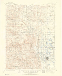
1907 Map of Livermore
USGS Topo · Published 1964About this map
The Colorado Wyoming Boundary Line defines the northern edge of this Larimer County landscape, where early ranching and mining interests shaped the foothills. Virginia Dale and the St Cloud P O serve as early focal points for the high-country settlements, while the town of Fort Collins begins its growth on the plains to the southeast. The complex water system is already taking shape with the Colorado and Southern R R moving freight near reservoirs like Richard Lake and Lindenmeier Lake. Industry is scattered throughout the canyons, evidenced by Ballards Sawmill near Buckhorn Creek and the Empire Mine south of Rist Canyon. Landmarks like the Forks Hotel near Livermore and the Campbell Grove School reflect the social infrastructure of the era, while topographic features like Robbers Roost and Steamboat Rock provided distinctive navigational points for travelers crossing into the Wyoming territory.
Find a feature on this map
104 named features on this map. Tap any name to fly to it.
Don’t see what you’re looking for? This feature index may not catch every label — zoom into the map to look around manually.
Map Details
Editions of this 1907 Livermore Map
2 editions found

Other maps of this area

1895 · Laramie
USGS Topo · 1:125,000

1902 · Laramie
USGS Topo · 1:125,000

1902 · Greeley
USGS Topo · 1:125,000

1905 · Sherman
USGS Topo · 1:125,000

1905 · Laramie
USGS Topo · 1:125,000

1905 · Mount Olympus
USGS Topo · 1:62,500

1906 · Loveland
USGS Topo · 1:62,500

1906 · Fort Collins
USGS Topo · 1:62,500

1906 · Laramie
USGS Topo · 1:125,000

1907 · Mount Olympus
USGS Topo · 1:62,500