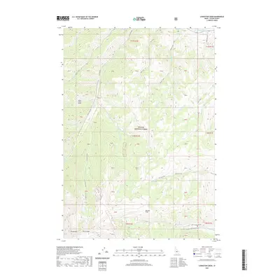
2020 Map of Livingston Creek
USGS Topo · Published 2020About this map
Challis National Forest encompasses this high-elevation landscape, where the dramatic White Cloud Peaks rise above a complex network of alpine drainages. The area is defined by sharp ridgelines like the Chinese Wall and The Gunsight, which separate glacial basins containing Crater Lake, Gunfight Lake, and Dike Lake. Evidence of early 20th-century industry and access remains via the Livingston Mill-Castle Divide route and the notably named Railroad Ridge, suggesting the reach of mining interests into these high summits.
Find a feature on this map
63 named features on this map. Tap any name to fly to it.
Don’t see what you’re looking for? This feature index may not catch every label — zoom into the map to look around manually.
Map Details
Editions of this 2020 Livingston Creek Map
This is the sole edition of this map. No revisions or reprints were ever made.
Other maps of this area

1919 · Custer
USGS Topo · 1:125,000

1922 · Custer
USGS Topo · 1:125,000

1929 · Bayhorse
USGS Topo · 1:125,000

1957 · Challis
USGS Topo · 1:250,000

1960 · Challis
USGS Topo · 1:250,000

1963 · Challis
USGS Topo · 1:250,000

1963 · Clayton
USGS Topo · 1:24,000
1963 · Potaman Peak
USGS Topo · 1:24,000

1963 · Clayton
USGS Topo · 1:62,500
1963 · Bowery Creek
USGS Topo · 1:24,000