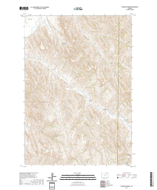
2021 Map of Livingston Draw
USGS Topo · Published 2021About this map
The Powder River cuts through the northwest corner of this Johnson County landscape, an area dominated by an intricate drainage system of named draws and divides. This survey reveals a deeply dissected terrain where the Kinney Divide separates various watercourses including Fortification Cr and Little Bull Cr. The geography is defined by its verticality and the many temporary water channels that have carved the earth, such as Windmill Draw, Stotts Draw, and Taylor Draw. The boundary between Johnson and Campbell counties runs north-to-south through the eastern portion of the map, crossed only by the primary thoroughfare of Fortification Rd. This map provides a clear view of the complex landforms and cattle-country hydrology that shaped the development of this part of Wyoming.
Find a feature on this map
19 named features on this map. Tap any name to fly to it.
Don’t see what you’re looking for? This feature index may not catch every label — zoom into the map to look around manually.
Map Details
Editions of this 2021 Livingston Draw Map
This is the sole edition of this map. No revisions or reprints were ever made.
Other maps of this area

1954 · Gillette
USGS Topo · 1:250,000

1955 · Sheridan
USGS Topo · 1:250,000

1955 · Gillette
USGS Topo · 1:250,000

1958 · Gillette
USGS Topo · 1:250,000

1958 · Sheridan
USGS Topo · 1:250,000

1962 · Gillette
USGS Topo · 1:250,000

1962 · Sheridan
USGS Topo · 1:250,000

1972 · Mitchell Draw
USGS Topo · 1:24,000
1972 · Carr Draw
USGS Topo · 1:24,000
1972 · Lariat
USGS Topo · 1:24,000