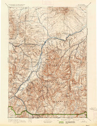
1893 Map of Livingston
USGS Topo · Published 1934About this map
Livingston serves as the central hub of this late-19th-century landscape, positioned where the Shields River meets the Yellowstone River. The area reflects a transitional period for the region, featuring the Old Crow Agency and the site of Ft Ellis (Abandoned), which had served its purpose before the railroad's arrival. The Northern Pacific Railroad corridor is the primary artery of movement, passing through Bozeman Pass and supporting smaller rail-dependent settlements like Hoppers and Cokedale.
Find a feature on this map
121 named features on this map. Tap any name to fly to it.
Don’t see what you’re looking for? This feature index may not catch every label — zoom into the map to look around manually.
Map Details
Editions of this 1893 Livingston Map
5 editions found
Other maps of this area

1885 · Gallatin
USGS Topo · 1:125,000

1885 · Gallatin
USGS Topo · 1:125,000

1886 · Fort Logan
USGS Topo · 1:250,000

1886 · Canyon
USGS Topo · 1:125,000

1886 · Little Belt Mts.
USGS Topo · 1:250,000

1888 · Three Forks
USGS Topo · 1:250,000

1889 · Big Snowy Mountain
USGS Topo · 1:250,000

1891 · Livingston
USGS Topo · 1:250,000

1891 · Big Timber
USGS Topo · 1:125,000

1893 · Livingston
USGS Topo · 1:250,000