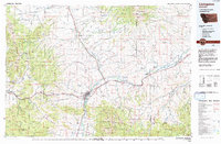
1992 Map of Livingston
USGS Topo · Published 1992About this map
Livingston serves as the central hub of this 1992 landscape, situated where the Yellowstone River emerges from the mountains into the broad Paradise Valley. The settlement pattern follows the river valley and the path of the Burlington Northern Railroad, which connects smaller locales like Springdale and Mission to the larger town. To the north and south, the terrain rises sharply into the Crazy Mountains and the Gallatin Range, showing a wilderness character dominated by the Gallatin National Forest and the Absaroka-Beartooth Wilderness.
Find a feature on this map
120 named features on this map. Tap any name to fly to it.
Don’t see what you’re looking for? This feature index may not catch every label — zoom into the map to look around manually.
Map Details
Editions of this 1992 Livingston Map
This is the sole edition of this map. No revisions or reprints were ever made.
Other maps of this area

1886 · Fort Logan
USGS Topo · 1:250,000

1886 · Little Belt Mts.
USGS Topo · 1:250,000

1888 · Three Forks
USGS Topo · 1:250,000

1889 · Big Snowy Mountain
USGS Topo · 1:250,000

1891 · Livingston
USGS Topo · 1:250,000

1891 · Big Timber
USGS Topo · 1:125,000

1893 · Livingston
USGS Topo · 1:250,000

1893 · Big Snowy Mountain
USGS Topo · 1:250,000

1893 · Big Timber
USGS Topo · 1:125,000

1894 · Three Forks
USGS Topo · 1:250,000