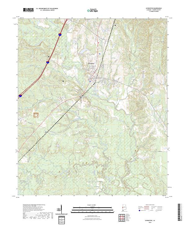
2024 Map of Livingston
USGS Topo · Published 2024About this map
The Sumter County Courthouse serves as the central anchor for Livingston, Alabama, a town shaped by its academic and civic history. The campus of the University of West Alabama occupies a significant portion of the northern landscape, adjacent to the meandering Sucarnoochee River. This 2024 survey documents the modern layout of the community, from the residential clusters along N Washington St to the more rural south where the settlement of Hixon and landmarks like Baldwin Hill are found.
Find a feature on this map
71 named features on this map. Tap any name to fly to it.
Don’t see what you’re looking for? This feature index may not catch every label — zoom into the map to look around manually.
Map Details
Editions of this 2024 Livingston Map
This is the sole edition of this map. No revisions or reprints were ever made.
Other maps of this area

1929 · Epes
USGS Topo · 1:48,000

1932 · Epes
USGS Topo · 1:62,500

1953 · Meridian
USGS Topo · 1:250,000

1957 · Meridian
USGS Topo · 1:250,000

1965 · Meridian
USGS Topo · 1:250,000

1971 · Coatopa
USGS Topo · 1:24,000

1971 · Bellamy
USGS Topo · 1:24,000

1974 · Boyd
USGS Topo · 1:24,000
1974 · Epes West
USGS Topo · 1:24,000
1974 · Epes East
USGS Topo · 1:24,000