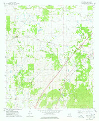
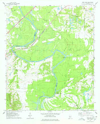
1974 Map of Epes West
USGS Topo · Published 1978About this map
Sumterville and the surrounding west Alabama countryside are documented here as they appeared in the mid-1970s. This survey records a landscape defined by small rural clusters and numerous family or community burial grounds, such as the Eskeridge-Pettigrew Cem and Brown Cem. The settlement pattern follows the drainage of local waterways like Turkey Creek and Jones Creek, while the Southern railroad line cuts through the eastern portion of the quadrangle near Epes. The map also captures infrastructure developments of the era, including a noted Pumping Station and a corridor marked as a proposed location for a new route. This record is particularly valuable for genealogists, as it preserves the exact locations of several small churches and cemeteries, including the Shiloh Cem and Jones Creek Ch, which served these dispersed farming communities.
Find a feature on this map
27 named features on this map. Tap any name to fly to it.
Don’t see what you’re looking for? This feature index may not catch every label — zoom into the map to look around manually.
Map Details
Editions of this 1974 Epes West Map
2 editions found
Other maps of this area

1929 · Epes
USGS Topo · 1:48,000

1932 · Epes
USGS Topo · 1:62,500

1953 · Meridian
USGS Topo · 1:250,000

1957 · Meridian
USGS Topo · 1:250,000

1965 · Meridian
USGS Topo · 1:250,000
1970 · Boligee
USGS Topo · 1:24,000

1970 · Gainesville
USGS Topo · 1:24,000
1973 · Geiger
USGS Topo · 1:24,000

1974 · Boyd
USGS Topo · 1:24,000
1974 · Epes East
USGS Topo · 1:24,000