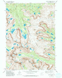
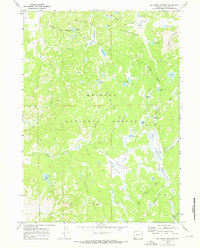
1981 Map of Lizard Head Peak
USGS Topo · Published 1992About this map
Lizard Head Peak stands as a central monument in this high-altitude landscape of the Wind River Range, where the Continental Divide separates the Shoshone National Forest to the east from the Bridger National Forest and Bridger Wilderness to the west. The area is defined by its dramatic glacial features, most notably the Cirque of the Towers, a collection of granite spires including Wolfs Head, Pingora Peak, and War Bonnet Peak. This 1981 edition captures a network of high-country water bodies like Lonesome Lake and Washakie Lake fed by the Washakie Glacier. The map serves as a vital record for tracing early routes like the Lizard Head Trail and the remote Pack Trail systems that provided access to these peaks and valleys before modern alpine recreation patterns were fully established. The boundary between Fremont and Sublette counties follows the serrated ridgelines of the divide.
Find a feature on this map
74 named features on this map. Tap any name to fly to it.
Don’t see what you’re looking for? This feature index may not catch every label — zoom into the map to look around manually.
Map Details
Editions of this 1981 Lizard Head Peak Map
4 editions found
Other maps of this area

1937 · Moccasin Lake
USGS Topo · 1:48,000

1938 · Mt Bonneville
USGS Topo · 1:62,500

1941 · Mt Bonneville
USGS Topo · 1:62,500

1942 · Mt Bonneville
USGS Topo · 1:62,500

1943 · Moccasin Lake
USGS Topo · 1:62,500

1953 · Sweetwater Gap
USGS Topo · 1:24,000

1955 · Lander
USGS Topo · 1:250,000

1958 · Lander
USGS Topo · 1:250,000

1961 · Lander
USGS Topo · 1:250,000
1969 · Big Sandy Opening
USGS Topo · 1:24,000