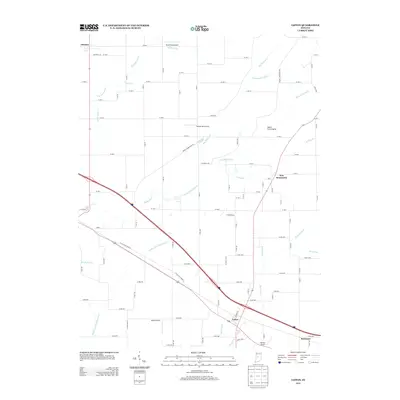
2013 Map of Lizton
USGS Topo · Published 2013About this map
Lizton and its surrounding rural landscapes are defined by an intricate network of drainage ditches and small creeks that feed into larger water systems. The terrain features the South Fork Prairie and is carved by Big Walnut Cr and its Middle Fork, as well as the South Fork Eel River. This agricultural area in Boone County is dotted with several small aviation facilities, including Haffner Airport, Hood Field Airport, Reimer Aerodrome, and Bergs Airport, indicating a local reliance on private flight.
Find a feature on this map
90 named features on this map. Tap any name to fly to it.
Don’t see what you’re looking for? This feature index may not catch every label — zoom into the map to look around manually.
Map Details
Editions of this 2013 Lizton Map
This is the sole edition of this map. No revisions or reprints were ever made.
Other maps of this area

1953 · Fayette
USGS Topo · 1:24,000

1953 · Lizton
USGS Topo · 1:24,000

1953 · Danville
USGS Topo · 1:24,000

1953 · Brownsburg
USGS Topo · 1:24,000

1953 · Lebanon
USGS Topo · 1:24,000

1953 · Danville
USGS Topo · 1:250,000

1953 · Indianapolis
USGS Topo · 1:250,000

1955 · Danville
USGS Topo · 1:250,000

1956 · Danville
USGS Topo · 1:250,000

1956 · Indianapolis
USGS Topo · 1:250,000