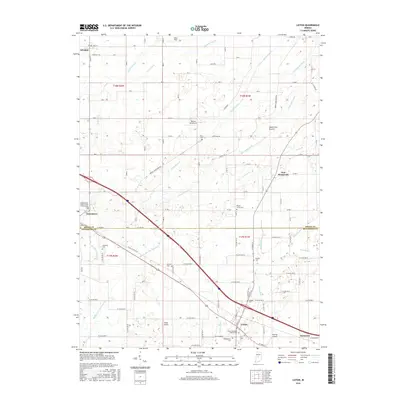
2016 Map of Lizton
USGS Topo · Published 2016About this map
The agrarian landscape of the Boone and Hendricks county line is defined by a dense network of drainage infrastructure and small-town junctions. Settlements like Lizton and Jamestown anchor the southern and western reaches, while the rural interior is marked by a high concentration of fraternal and pioneer burial grounds. Genealogists may find particular interest in the Independent Order of Odd Fellows Cem and the Lizton Knights of Pythias Cem, reflecting the civic and fraternal history of these Indiana communities. The land is drained by a complex system of waterways including Big Walnut Creek and the S Fork Eel River, supplemented by numerous named channels like Main Edlin Ditch and Higgins Ditch. Aviation history is well-represented across the prairie by private facilities such as Bergs Airport, Haffner Airport, and the Reimer Aerodrome, illustrating the importance of small-scale flight in this region of South Fork Prairie.
Find a feature on this map
53 named features on this map. Tap any name to fly to it.
Don’t see what you’re looking for? This feature index may not catch every label — zoom into the map to look around manually.
Map Details
Editions of this 2016 Lizton Map
This is the sole edition of this map. No revisions or reprints were ever made.
Other maps of this area

1953 · Fayette
USGS Topo · 1:24,000

1953 · Lizton
USGS Topo · 1:24,000

1953 · Danville
USGS Topo · 1:24,000

1953 · Brownsburg
USGS Topo · 1:24,000

1953 · Lebanon
USGS Topo · 1:24,000

1953 · Danville
USGS Topo · 1:250,000

1953 · Indianapolis
USGS Topo · 1:250,000

1955 · Danville
USGS Topo · 1:250,000

1956 · Danville
USGS Topo · 1:250,000

1956 · Indianapolis
USGS Topo · 1:250,000