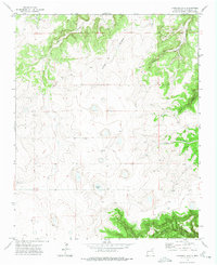
1972 Map of Llonidas Lake
USGS Topo · Published 1975About this map
Llonidas Lake sits at the heart of this high-altitude landscape in northeast New Mexico, where the boundary between Mora County and San Miguel County runs through a series of dramatic canyon systems. The 1972 topography reveals a remote ranching environment defined by numerous ca%f1ons that drain the surrounding mesas, including Ca%f1on Cibolo and Ca%f1on Pinabete.
Find a feature on this map
16 named features on this map. Tap any name to fly to it.
Don’t see what you’re looking for? This feature index may not catch every label — zoom into the map to look around manually.
Map Details
Editions of this 1972 Llonidas Lake Map
This is the sole edition of this map. No revisions or reprints were ever made.
Other maps of this area

1892 · Watrous
USGS Topo · 1:125,000

1894 · Watrous
USGS Topo · 1:125,000

1954 · Santa Fe
USGS Topo · 1:250,000

1958 · Santa Fe
USGS Topo · 1:250,000

1964 · Frutosa Lake
USGS Topo · 1:24,000

1964 · Canon Ancho
USGS Topo · 1:24,000
1966 · Cherry Valley Lake
USGS Topo · 1:24,000

1971 · Laguna Huerfana
USGS Topo · 1:24,000
1971 · Canon Pedroso
USGS Topo · 1:24,000

1971 · Trujillo
USGS Topo · 1:24,000