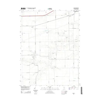
2015 Map of Loami
USGS Topo · Published 2015About this map
Loami serves as the central hub of this agricultural landscape in Sangamon County, where a dense network of country roads connects family-named landmarks and historical burial sites. The terrain is defined by the winding paths of Lick Cr and Polecat Cr, which carve through the farmland southwest of Springfield. For genealogists, the map is remarkably dense with cemeteries, including Patterson Cem, Shelton Cem, and John Campbell Cem, indicating the long-standing settlement of the area. Small communities such as Knapp and Bates sit along the corridors of Old Route 54 and the rail line, reflecting a transport-driven development pattern. North of Loami, Sudduth Lake and the branching S-Fork Lick Cr provide a look at the local drainage systems that have influenced land use and property boundaries since the early days of Illinois statehood.
Find a feature on this map
44 named features on this map. Tap any name to fly to it.
Don’t see what you’re looking for? This feature index may not catch every label — zoom into the map to look around manually.
Map Details
Editions of this 2015 Loami Map
This is the sole edition of this map. No revisions or reprints were ever made.
Other maps of this area

1907 · Springfield
USGS Topo · 1:62,500

1909 · Tallula
USGS Topo · 1:62,500

1922 · Divernon
USGS Topo · 1:62,500

1924 · Divernon
USGS Topo · 1:62,500

1924 · Waverly
USGS Topo · 1:62,500

1926 · Waverly
USGS Topo · 1:62,500

1930 · Springfield
USGS Topo · 1:62,500

1940 · Tallula
USGS Topo · 1:62,500

1940 · Springfield
USGS Topo · 1:62,500

1950 · Springfield West
USGS Topo · 1:24,000