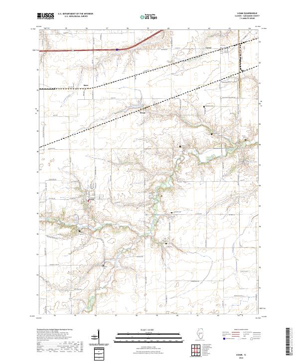
2024 Map of Loami
USGS Topo · Published 2024About this map
Lick Creek and its southern tributaries, including South Fork Lick Creek, carve a winding path through the heart of this Sangamon County landscape. The village of Loami serves as a local anchor, situated near the headwaters of Lake Loami and the crossing of Lick Rd. The surrounding countryside is defined by a dense network of family and community history, evidenced by the numerous burial grounds distributed across the townships. From Patterson Cem and Shelton Cem in the north to Sulphur Springs Cem and Oak Grove Cem further south, these sites offer significant touchpoints for genealogical research. The northern section of the map is marked by the transportation corridor near Curran and the settlement of Bates, where Old Rte 54 and the railroad alignment parallel Archer Creek. This map documents a stable agricultural region where modern infrastructure intersects with nineteenth-century settlement patterns.
Find a feature on this map
71 named features on this map. Tap any name to fly to it.
Don’t see what you’re looking for? This feature index may not catch every label — zoom into the map to look around manually.
Map Details
Editions of this 2024 Loami Map
This is the sole edition of this map. No revisions or reprints were ever made.
Other maps of this area

1907 · Springfield
USGS Topo · 1:62,500

1909 · Tallula
USGS Topo · 1:62,500

1922 · Divernon
USGS Topo · 1:62,500

1924 · Divernon
USGS Topo · 1:62,500

1924 · Waverly
USGS Topo · 1:62,500

1926 · Waverly
USGS Topo · 1:62,500

1930 · Springfield
USGS Topo · 1:62,500

1940 · Tallula
USGS Topo · 1:62,500

1940 · Springfield
USGS Topo · 1:62,500

1950 · Springfield West
USGS Topo · 1:24,000