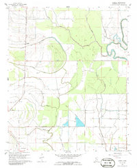
1967 Map of Lobdell
USGS Topo · Published 1986About this map
Meandering bayous and a complex drainage network define this Delta landscape in Bolivar County. The Illinois Central railroad serves as a primary north-south corridor, passing through the settlement of Lobdell. This area is marked by significant cultural history, including an Indian Mound near Christmas Lake and several rural worship sites like Rice Chapel and Macedonia Ch. The presence of cemeteries such as Polk-Royal Cem and Egypt Ridge Cem provides specific points of interest for genealogical research.
Find a feature on this map
27 named features on this map. Tap any name to fly to it.
Don’t see what you’re looking for? This feature index may not catch every label — zoom into the map to look around manually.
Map Details
Editions of this 1967 Lobdell Map
2 editions found

Other maps of this area

1933 · Lamont
USGS Topo · 1:62,500

1939 · Pace
USGS Topo · 1:62,500

1939 · Big Island
USGS Topo · 1:62,500

1939 · Lamont
USGS Topo · 1:62,500

1939 · Choctaw
USGS Topo · 1:62,500

1953 · Greenwood
USGS Topo · 1:250,000

1956 · Greenwood
USGS Topo · 1:250,000

1967 · Stringtown
USGS Topo · 1:24,000
1967 · Skene
USGS Topo · 1:24,000
1967 · Shaw
USGS Topo · 1:24,000