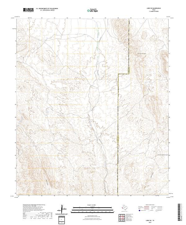
2023 Map of Lobo SW
USGS Topo · Published 2023About this map
The Van Horn Mountains dominate this arid landscape along the border of Hudspeth and Culberson counties. This terrain is defined by its dramatic vertical relief, where steep drainage systems like Eagle Canyon and Echo Canyon carve through the high ground. The Green River serves as the primary hydrological feature, followed closely by the winding Green River Rd, reflecting a landscape where transport and water naturally follow the same narrow desert corridors. Smaller water sources like Wilson Spring and ephemeral flows such as Echo Creek highlight the scarce resources vital to ranching operations in this part of the Trans-Pecos. The topography reveals several smaller named clefts, including Hammer Handle Canyon and China Canyon, illustrating the complex erosion patterns typical of the West Texas highlands.
Find a feature on this map
10 named features on this map. Tap any name to fly to it.
Don’t see what you’re looking for? This feature index may not catch every label — zoom into the map to look around manually.
Map Details
Editions of this 2023 Lobo SW Map
This is the sole edition of this map. No revisions or reprints were ever made.
Other maps of this area

1892 · Chispa
USGS Topo · 1:125,000

1895 · Chispa
USGS Topo · 1:125,000

1897 · Eagle Mountain
USGS Topo · 1:125,000

1897 · Chispa
USGS Topo · 1:125,000

1916 · Eagle Mountain
USGS Topo · 1:125,000

1959 · Marfa
USGS Topo · 1:250,000

1965 · Marfa
USGS Topo · 1:250,000
1972 · Van Horn Wells
USGS Topo · 1:24,000
1972 · Lobo
USGS Topo · 1:24,000
1972 · Lobo SW
USGS Topo · 1:24,000