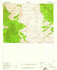
1958 Map of Lochiel
USGS Topo · Published 1959About this map
Mining camps and isolated ranches define this high-elevation landscape along the international boundary in the late 1950s. The dense concentration of silver, lead, and copper claims in the Patagonia Mountains is evident through sites like Harshaw, Washington Camp, and Duquesne. Numerous smaller operations such as the Mowry Mine and Endless Chain Mine dot the slopes of American Peak and Mt Washington, showing the intensity of 19th and early 20th-century extraction. To the east, the terrain opens into the San Rafael Valley, where the headwaters of the Santa Cruz River flow through a broad cattle-grazing territory marked by family holdings like the Heady-Ashburn Ranch and Greene Ranch. At the southern edge, the border settlement of Lochiel sits directly on the United States Mexico line, featuring the US Customhouse and the Fray Marcos de Niza Historic Monument, which commemorates early Spanish exploration through this pass into the interior.
Find a feature on this map
103 named features on this map. Tap any name to fly to it.
Don’t see what you’re looking for? This feature index may not catch every label — zoom into the map to look around manually.
Map Details
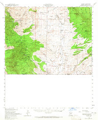
Editions of this 1958 Lochiel Map
2 editions found
Other maps of this area

1904 · Patagonia
USGS Topo · 1:125,000

1905 · Patagonia
USGS Topo · 1:125,000

1905 · Nogales
USGS Topo · 1:125,000

1914 · Hereford
USGS Topo · 1:125,000

1915 · Benson
USGS Topo · 1:125,000

1922 · Agus Caliente
USGS Topo · 1:62,500

1922 · Sunnyside
USGS Topo · 1:62,500

1932 · Lochiel
USGS Topo · 1:62,500

1932 · Elgin
USGS Topo · 1:62,500

1933 · Calabasas
USGS Topo · 1:62,500