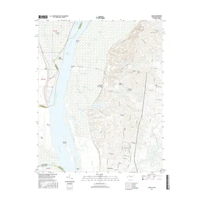
2016 Map of Locke
USGS Topo · Published 2016About this map
Chickasaw Bluff Number Three rises sharply above the expansive wetlands and riverine bottomlands where the Mississippi River forms a complex boundary between Tennessee and Arkansas. This 2016 survey documents a landscape of shifting waters and managed drainage, featuring an intricate network of sloughs and bayous such as Big Cypress Slough and Barnshee Bayou. The higher ground to the east is punctuated by local settlements like Locke and Benjestown, along with numerous small cemeteries that serve as vital markers for genealogical research, including Mount Pisgah Cem and Saint Paul Cem. The area also supports regional infrastructure and recreation, evidenced by the Shoemaker-Shelby Forest Airport and numerous lakes like Marie Lake and Chase Lake Number One. The contrast between the alluvial floodplains of Brandywine Island and the upland developments near Giles Town illustrates the geographic dualism of the northern Shelby County area.
Find a feature on this map
77 named features on this map. Tap any name to fly to it.
Don’t see what you’re looking for? This feature index may not catch every label — zoom into the map to look around manually.
Map Details
Editions of this 2016 Locke Map
This is the sole edition of this map. No revisions or reprints were ever made.
Other maps of this area

1916 · Memphis
USGS Topo · 1:62,500

1925 · Memphis
USGS Topo · 1:48,000

1927 · Memphis
USGS Topo · 1:62,500

1931 · Jericho
USGS Topo · 1:62,500

1939 · Jericho
USGS Topo · 1:62,500

1939 · Memphis
USGS Topo · 1:62,500

1942 · Millington
USGS Topo · 1:62,500

1952 · Jericho
USGS Topo · 1:62,500

1953 · Memphis
USGS Topo · 1:250,000

1955 · Memphis
USGS Topo · 1:62,500