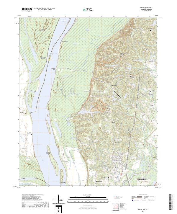
2022 Map of Locke
USGS Topo · Published 2022About this map
The Mississippi River carves a complex course along the Arkansas and Tennessee border, defining a landscape of shifting bars and backwater chutes. This riparian environment is shaped by dynamic water features such as Old Brandywine Chute and Island 40 Chute, which isolate Brandywine Island and Beef Island from the mainland. The dramatic topography of Chickasaw Bluff Number Three rises above the alluvial plain, providing a high-ground anchor for the sprawling Meeman-Shelby Forest State Park and the nearby Shoemaker Shelby Forest Airport.
Find a feature on this map
100 named features on this map. Tap any name to fly to it.
Don’t see what you’re looking for? This feature index may not catch every label — zoom into the map to look around manually.
Map Details
Editions of this 2022 Locke Map
This is the sole edition of this map. No revisions or reprints were ever made.
Other maps of this area

1916 · Memphis
USGS Topo · 1:62,500

1925 · Memphis
USGS Topo · 1:48,000

1927 · Memphis
USGS Topo · 1:62,500

1931 · Jericho
USGS Topo · 1:62,500

1939 · Jericho
USGS Topo · 1:62,500

1939 · Memphis
USGS Topo · 1:62,500

1942 · Millington
USGS Topo · 1:62,500

1952 · Jericho
USGS Topo · 1:62,500

1953 · Memphis
USGS Topo · 1:250,000

1955 · Memphis
USGS Topo · 1:62,500