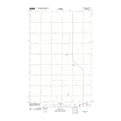
2010 Map of Lockhart
USGS Topo · Published 2010About this map
The settlement of Lockhart serves as the focal point of this Red River Valley landscape, where a rigorous grid of section-line roads defines the agricultural character of the region. This 2010 survey illustrates a quintessential Midwestern prairie township layout, anchored by essential community landmarks. Genealogists and local historians can locate the German Methodist Cemetery along County Hwy-121 and the Immanuel Lutheran Cemetery further south near 260th Ave. The terrain is remarkably flat, shaped by the ancient lakebed of the north-flowing drainage system, with the township structure governed by major thoroughfares such as County Hwy-1 and County Hwy-18. The map documents the enduring infrastructure of rural Norman County, showing how drainage patterns and transport routes like County Hwy-3 continue to dictate the placement of farmsteads and small crossroads communities.
Find a feature on this map
22 named features on this map. Tap any name to fly to it.
Don’t see what you’re looking for? This feature index may not catch every label — zoom into the map to look around manually.
Map Details
Editions of this 2010 Lockhart Map
This is the sole edition of this map. No revisions or reprints were ever made.
Other maps of this area

1918 · Twin Valley
USGS Topo · 1:62,500

1919 · Beltrami
USGS Topo · 1:62,500

1924 · Ada
USGS Topo · 1:62,500

1952 · Grand Forks
USGS Topo · 1:250,000

1956 · Grand Forks
USGS Topo · 1:250,000

1964 · Beltrami
USGS Topo · 1:24,000

1964 · Beltrami SW
USGS Topo · 1:24,000

1965 · Lockhart
USGS Topo · 1:24,000

1965 · Melvin
USGS Topo · 1:24,000

1965 · Anthony
USGS Topo · 1:24,000