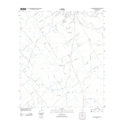
2013 Map of Lockhart South
USGS Topo · Published 2013About this map
Joliet serves as a central point of reference in this landscape south of the county seat, where the economy is defined by a mix of aviation, ranching, and petroleum. The southern edge of the sheet is marked by the Luling Oil Field, highlighting the region's industrial ties to energy production. Waterways like Clear Fork Plum Cr and W Fork Plum Cr drain the territory, which is punctuated by numerous family and community burial grounds, including Hall Cem, Harrison Cem, and Vogel Cem. The presence of the Lockhart Municipal Airport and the privately listed Someday Ranch Airport reflects the importance of air travel and large landholdings in this part of Texas. Modern infrastructure is represented by a network of Farm to Market roads such as FM-1322 and FM-571, which connect the rural homesteads to the developing outskirts of the city.
Find a feature on this map
94 named features on this map. Tap any name to fly to it.
Don’t see what you’re looking for? This feature index may not catch every label — zoom into the map to look around manually.
Map Details
Editions of this 2013 Lockhart South Map
This is the sole edition of this map. No revisions or reprints were ever made.
Other maps of this area

1911 · San Marcos
USGS Topo · 1:125,000

1919 · San Marcos
USGS Topo · 1:125,000

1925 · San Marcos 1-d
USGS Topo · 1:48,000

1925 · San Marcos 4-a
USGS Topo · 1:48,000

1929 · Luling
USGS Topo · 1:62,500

1930 · Lockhart
USGS Topo · 1:62,500

1930 · Seguin
USGS Topo · 1:62,500

1953 · Seguin
USGS Topo · 1:250,000

1958 · Seguin
USGS Topo · 1:250,000

1963 · Lockhart North
USGS Topo · 1:24,000