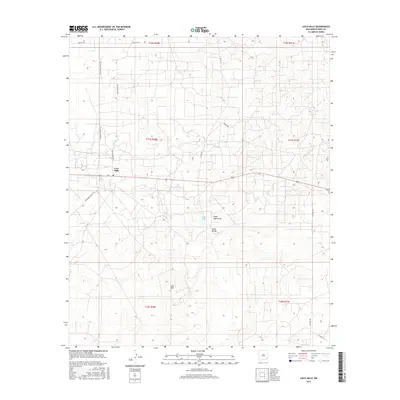
2017 Map of Loco Hills
USGS Topo · Published 2017About this map
Loco Hills sits at the center of this landscape in the southeastern corner of New Mexico, where the plains of Eddy County are defined by a network of ranching and utility roads. The terrain is marked by significant hydrological and geographic features like the Cedar Lake basin and the Cedar Lake Draw, which provide crucial drainage across this semi-arid region. These natural depressions and the Cedar Breaks escarpment influenced the placement of local transportation routes, including Mallet Rd and Skelly Rd. The map illustrates a modern survey of the Public Land Survey System, showing the township and range divisions such as t17s r30e and t17s r31e. For those tracking the evolution of land use in the Permian Basin, the dense grid of secondary roads like Hagerman Cutoff Rd and Goat Ropers Rd reveals the intensive activity surrounding this isolated settlement.
Find a feature on this map
18 named features on this map. Tap any name to fly to it.
Don’t see what you’re looking for? This feature index may not catch every label — zoom into the map to look around manually.
Map Details
Editions of this 2017 Loco Hills Map
This is the sole edition of this map. No revisions or reprints were ever made.
Other maps of this area

1942 · Clayton Basin
USGS Topo · 1:62,500

1943 · Clayton Basin
USGS Topo · 1:62,500

1943 · Oil City
USGS Topo · 1:62,500

1953 · Basin Well
USGS Topo · 1:24,000

1954 · Carlsbad
USGS Topo · 1:250,000

1954 · Hobbs
USGS Topo · 1:250,000

1955 · Red Lake SE
USGS Topo · 1:24,000

1958 · Carlsbad
USGS Topo · 1:250,000

1958 · Hobbs
USGS Topo · 1:250,000

1963 · Maljamar
USGS Topo · 1:62,500