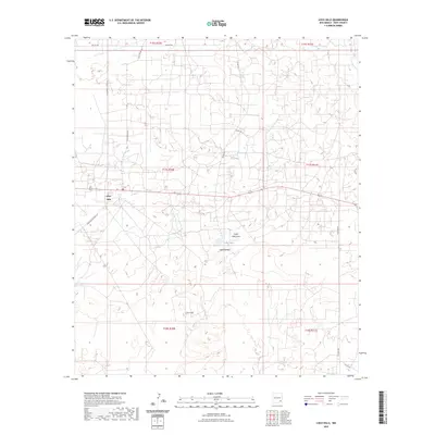
2023 Map of Loco Hills
USGS Topo · Published 2023About this map
Loco Hills sits at the center of this 2023 survey of Eddy County, New Mexico, marking a landscape defined by industrial access and subtle desert topography. The settlement is surrounded by a dense network of oil and gas service roads, including the evocatively named Goat Ropers Rd, Hagerman Cutoff Rd, and Skelly Rd. This grid-heavy development contrasts with the natural drainage patterns of the Cedar Lake Draw, which feeds into Cedar Lake near the area known as Cedar Breaks. The mapping reveals a modern intersection of high-desert terrain and the active energy infrastructure of the Permian Basin, where historical ranching routes have been reinforced by decades of mineral extraction. These features provide a clear view of the 21st-century footprint of this specialized community and the surrounding public land survey system.
Find a feature on this map
18 named features on this map. Tap any name to fly to it.
Don’t see what you’re looking for? This feature index may not catch every label — zoom into the map to look around manually.
Map Details
Editions of this 2023 Loco Hills Map
This is the sole edition of this map. No revisions or reprints were ever made.
Other maps of this area

1942 · Clayton Basin
USGS Topo · 1:62,500

1943 · Clayton Basin
USGS Topo · 1:62,500

1943 · Oil City
USGS Topo · 1:62,500

1953 · Basin Well
USGS Topo · 1:24,000

1954 · Carlsbad
USGS Topo · 1:250,000

1954 · Hobbs
USGS Topo · 1:250,000

1955 · Red Lake SE
USGS Topo · 1:24,000

1958 · Carlsbad
USGS Topo · 1:250,000

1958 · Hobbs
USGS Topo · 1:250,000

1963 · Maljamar
USGS Topo · 1:62,500