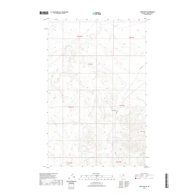
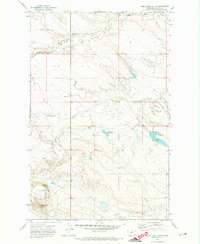
2020 Map of Lodge Pole NE
USGS Topo · Published 2020About this map
Black Butte rises as a prominent landmark in this northern Montana landscape, anchoring a region defined by its complex drainage systems and open terrain. The hydrological network is centered on the winding paths of Peoples Cr and its S Fork Peoples Cr, which carve through the northern sections of the map. In the south, the headwaters of Lodge Pole Cr emerge, illustrating the area's role in the local watershed. The topography is further characterized by deep erosion features like Corral Coulee and Wolf Coulee, which provide significant relief against the surrounding plains. Transportation through this rural area is facilitated by Indian Hwy 8, also identified as Rte 8, which serves as the primary artery connecting the various townships. This 2020 survey provides a clear view of the modern rural infrastructure and natural geographic boundaries within the Fort Belknap Reservation area.
Find a feature on this map
14 named features on this map. Tap any name to fly to it.
Don’t see what you’re looking for? This feature index may not catch every label — zoom into the map to look around manually.
Map Details
Editions of this 2020 Lodge Pole NE Map
This is the sole edition of this map. No revisions or reprints were ever made.
Other maps of this area

1953 · Havre
USGS Topo · 1:250,000

1957 · Havre
USGS Topo · 1:250,000

1958 · Havre
USGS Topo · 1:250,000

1964 · Weigand Reservoir
USGS Topo · 1:24,000

1971 · Lodge Pole NW
USGS Topo · 1:24,000

1971 · Lodge Pole NE
USGS Topo · 1:24,000
1971 · Stiffarm Coulee
USGS Topo · 1:24,000
1971 · Lodge Pole
USGS Topo · 1:24,000
1971 · Bigby Lake
USGS Topo · 1:24,000
1971 · Wild Horse Butte
USGS Topo · 1:24,000