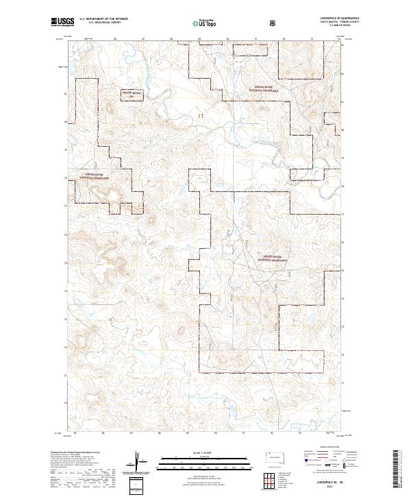
2021 Map of Lodgepole SE
USGS Topo · Published 2021About this map
Grand River National Grassland dominates this section of Perkins County, where the high plains are carved by a network of drainage systems. The landscape is defined by the winding course of the North Fork Grand River in the north and the eastward flow of Lodgepole Creek through the southern half of the quadrangle. This 2021 survey illustrates a sparse, open rangeland with few developed arteries, primarily consisting of Castlebutte Rd and 111th St. The mapping of these public lands emphasizes the characteristic township and range divisions, showing the grid-like organization of the Dakotas even in this undeveloped area. Researchers can trace the subtle topography of the creek valleys and the extensive grassland boundaries that shape the local geography and land use in this part of the state.
Find a feature on this map
11 named features on this map. Tap any name to fly to it.
Don’t see what you’re looking for? This feature index may not catch every label — zoom into the map to look around manually.
Map Details
Editions of this 2021 Lodgepole SE Map
This is the sole edition of this map. No revisions or reprints were ever made.
Other maps of this area

1954 · Lemmon
USGS Topo · 1:250,000

1957 · Lemmon
USGS Topo · 1:250,000

1974 · Hettinger South
USGS Topo · 1:24,000

1974 · Kid Rich Butte
USGS Topo · 1:24,000

1974 · Haynes
USGS Topo · 1:24,000

1983 · Lodgepole SE
USGS Topo · 1:24,000

1983 · Cole Dam
USGS Topo · 1:24,000

1983 · Little Nasty Creek
USGS Topo · 1:24,000

1983 · Bison NW
USGS Topo · 1:24,000
1983 · Haynes SW
USGS Topo · 1:24,000