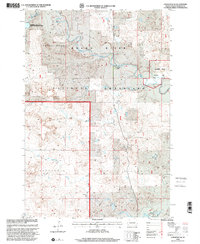
1998 Map of Lodgepole SE
USGS Topo · Published 2001About this map
The Grand River National Grassland dominates this landscape in Perkins County, where the North Fork Grand River meanders through wide valleys and rugged draws. This region of the northern Great Plains shows a careful balance of public land management and private ranching, evidenced by features like the R Sonn Ranch situated near the riverbanks. The topography is defined by prominent elevations such as Castle Butte and the drainage system of Lodgepole Creek, which flows towards the small settlement of Lodgepole.
Find a feature on this map
12 named features on this map. Tap any name to fly to it.
Don’t see what you’re looking for? This feature index may not catch every label — zoom into the map to look around manually.
Map Details
Editions of this 1998 Lodgepole SE Map
This is the sole edition of this map. No revisions or reprints were ever made.
Other maps of this area

1954 · Lemmon
USGS Topo · 1:250,000

1957 · Lemmon
USGS Topo · 1:250,000

1974 · Hettinger South
USGS Topo · 1:24,000

1974 · Kid Rich Butte
USGS Topo · 1:24,000

1974 · Haynes
USGS Topo · 1:24,000

1983 · Lodgepole SE
USGS Topo · 1:24,000

1983 · Cole Dam
USGS Topo · 1:24,000

1983 · Little Nasty Creek
USGS Topo · 1:24,000

1983 · Bison NW
USGS Topo · 1:24,000
1983 · Haynes SW
USGS Topo · 1:24,000