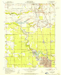
1953 Map of Lodi North
USGS Topo · Published 1953About this map
The Mokelumne River snakes through the heart of this Central Valley landscape, defining the agricultural character of San Joaquin and Sacramento counties. The city of Lodi dominates the southern portion of the sheet, showing a developed street grid featuring Grape Festival Buildings, Municipal Stadium, and several schools including Washington Sch and St Annes Academy. Just to the northwest, the settlement of Woodbridge sits at the river's edge, marked by the Woodbridge Canal and the KCVR Radio Tower.
Find a feature on this map
64 named features on this map. Tap any name to fly to it.
Don’t see what you’re looking for? This feature index may not catch every label — zoom into the map to look around manually.
Map Details
Editions of this 1953 Lodi North Map
2 editions found

Other maps of this area

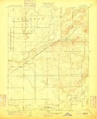
1894 · Lodi
USGS Topo · 1:125,000

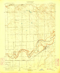
1908 · Waterloo
USGS Topo · 1:31,680
1908 · Lockeford
USGS Topo · 1:31,680
1909 · Clay
USGS Topo · 1:31,680

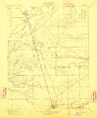
1910 · New Hope
USGS Topo · 1:31,680

1910 · Castle
USGS Topo · 1:31,680

1910 · Woodbridge
USGS Topo · 1:31,680

1910 · Bruceville
USGS Topo · 1:31,680

1910 · Headreach
USGS Topo · 1:31,680
1910 · Galt
USGS Topo · 1:31,680