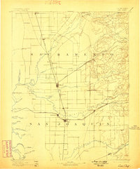
1894 Map of Lodi
USGS Topo · Published 1898About this map
The Mokelumne River and Cosumnes River define this 1890s agricultural and rail corridor, where the Central Pacific Railroad links the growing settlements of Lodi, Galt, and Elk Grove. This late-19th-century survey highlights a landscape transitioning from the gold rush era into a settled interior valley, featuring early river transport hubs like New Hope Landing and Woodbridge. In the eastern foothills, landmarks such as Alabama House and Michigan Bar suggest the region's mining and hospitality history, while the Amador Branch Railroad branches off toward the Sierra Nevada foothills. The map reveals a complex web of waterways including the Calaveras River and numerous sloughs like Sycamore Slough and White Slough, illustrating the intricate natural drainage system of the Central Valley before modern large-scale irrigation and flood control altered the terrain.
Find a feature on this map
65 named features on this map. Tap any name to fly to it.
Don’t see what you’re looking for? This feature index may not catch every label — zoom into the map to look around manually.
Map Details
Editions of this 1894 Lodi Map
3 editions found
Other maps of this area

1889 · Jackson
USGS Topo · 1:125,000

1891 · Sacramento
USGS Topo · 1:125,000

1891 · Placerville
USGS Topo · 1:125,000

1892 · Jackson
USGS Topo · 1:125,000

1892 · Sacramento
USGS Topo · 1:125,000

1892 · Placerville
USGS Topo · 1:125,000

1893 · Placerville
USGS Topo · 1:125,000

1893 · Sacramento
USGS Topo · 1:125,000

1894 · Lodi
USGS Topo · 1:125,000

1897 · Jackson
USGS Topo · 1:125,000