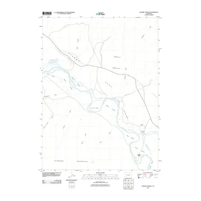
2010 Map of Lodore School
USGS Topo · Published 2010About this map
The Green River carves a winding path through this corner of Moffat County, defining the alluvial landscape of Browns Park. The river’s course is marked by a series of named bottomlands that suggest a history of riparian land use, including Harry Hoy Bottom, Nelson Bottom, and Allen Bottom. These fertile stretches are framed by the higher elevations of Diamond Mountain and dissected by numerous drainage features such as Spitzie Draw and Yellow Jacket Draw.
Find a feature on this map
32 named features on this map. Tap any name to fly to it.
Don’t see what you’re looking for? This feature index may not catch every label — zoom into the map to look around manually.
Map Details
Editions of this 2010 Lodore School Map
This is the sole edition of this map. No revisions or reprints were ever made.
Other maps of this area

1885 · Ashley
USGS Topo · 1:250,000

1952 · Willow Creek Butte
USGS Topo · 1:24,000

1952 · Swallow Canyon
USGS Topo · 1:24,000

1954 · Lodore School
USGS Topo · 1:24,000

1954 · Canyon of Lodore North
USGS Topo · 1:24,000

1954 · Vernal
USGS Topo · 1:250,000

1958 · Vernal
USGS Topo · 1:250,000

1960 · Vernal
USGS Topo · 1:250,000
1966 · Beaver Basin
USGS Topo · 1:24,000

1966 · Big Joe Basin
USGS Topo · 1:24,000