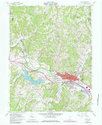
1961 Map of Logan
USGS Topo · Published 1985About this map
The Hocking River winds through this Hocking County landscape, defining the character of Logan and its smaller neighbors, West Logan and South Logan. At the center of town, the Courthouse and East School anchor the community, while the County Fairground and Sewage Disposal facility occupy the river's eastern banks. The era's economic infrastructure is evident in the numerous Oil Wells peppered across the hillsides and a Strip Mine located south of the main settlement.
Find a feature on this map
55 named features on this map. Tap any name to fly to it.
Don’t see what you’re looking for? This feature index may not catch every label — zoom into the map to look around manually.
Map Details
Editions of this 1961 Logan Map
4 editions found
Other maps of this area

1904 · Zaleski
USGS Topo · 1:62,500

1907 · Zaleski
USGS Topo · 1:62,500

1907 · Logan
USGS Topo · 1:62,500

1907 · Lancaster
USGS Topo · 1:62,500

1909 · Lancaster
USGS Topo · 1:62,500

1909 · Logan
USGS Topo · 1:62,500

1910 · Laurelville
USGS Topo · 1:62,500

1912 · Laurelville
USGS Topo · 1:62,500

1944 · Laurelville
USGS Topo · 1:62,500

1947 · Columbus
USGS Topo · 1:250,000