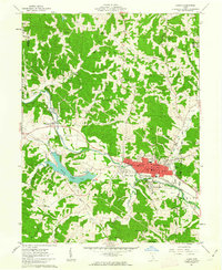
1961 Map of Logan
USGS Topo · Published 1963About this map
The Hocking River winds through this early 1960s landscape, serving as the primary geographic corridor for the city of Logan and the neighboring settlements of Enterprise, West Logan, and South Logan. The region's industrial character is defined by the Chesapeake and Ohio railroad line following the river valley, flanked by numerous oil wells and active extraction sites including a strip mine and several kilns. The map reveals a deeply etched terrain of ridges like Calico Ridge and hills such as Schultz Hill, punctuated by a dense network of local landmarks.
Find a feature on this map
73 named features on this map. Tap any name to fly to it.
Don’t see what you’re looking for? This feature index may not catch every label — zoom into the map to look around manually.
Map Details
Editions of this 1961 Logan Map
4 editions found
Other maps of this area

1904 · Zaleski
USGS Topo · 1:62,500

1907 · Zaleski
USGS Topo · 1:62,500

1907 · Logan
USGS Topo · 1:62,500

1907 · Lancaster
USGS Topo · 1:62,500

1909 · Lancaster
USGS Topo · 1:62,500

1909 · Logan
USGS Topo · 1:62,500

1910 · Laurelville
USGS Topo · 1:62,500

1912 · Laurelville
USGS Topo · 1:62,500

1944 · Laurelville
USGS Topo · 1:62,500

1947 · Columbus
USGS Topo · 1:250,000