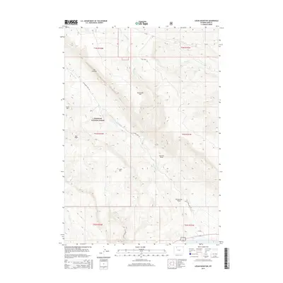
2015 Map of Logan Mountain
USGS Topo · Published 2015About this map
Shoshone National Forest lands dominate this part of Park County, where the high ridges of the Absaroka Range meet the deep drainage of Rattlesnake Canyon. This 2015 U.S. Geological Survey study details a landscape defined by significant peaks, including Rattlesnake Mtn, Logan Mtn, and the distinctive Chalk Mtn. The hydrology of the area is centered on Rattlesnake Creek, which is fed by seasonal sources such as Trough Spring and Blue Springs. Human access is primarily limited to forest routes like Rattlesnake Creek Rd and Trail Creek Rd, which navigate the steep transition from the heights of The Palisades down toward the creek beds. This map provides a contemporary record of federal land management and topography in a region where few permanent settlements exist, focusing instead on named natural landmarks and the complex trail-and-road network used by modern explorers and conservationists.
Find a feature on this map
25 named features on this map. Tap any name to fly to it.
Don’t see what you’re looking for? This feature index may not catch every label — zoom into the map to look around manually.
Map Details
Editions of this 2015 Logan Mountain Map
This is the sole edition of this map. No revisions or reprints were ever made.
Other maps of this area

1949 · Pat O'Hara Mountain
USGS Topo · 1:62,500

1949 · Cody
USGS Topo · 1:62,500

1951 · Cody
USGS Topo · 1:62,500

1955 · Cody
USGS Topo · 1:250,000

1957 · Wapiti
USGS Topo · 1:62,500

1957 · Devils Tooth
USGS Topo · 1:62,500

1958 · Cody
USGS Topo · 1:250,000

1962 · Cody
USGS Topo · 1:250,000

1980 · Carter Mountain
USGS Topo · 1:100,000

1980 · Cody
USGS Topo · 1:100,000