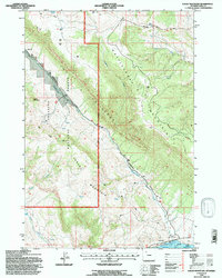
1991 Map of Logan Mountain
USGS Topo · Published 1997About this map
Logan Mountain and Rattlesnake Mountain define this high-elevation landscape within the Shoshone National Forest. The map documents a dramatic vertical transition from the southern edge of the Buffalo Bill Reservoir up through the steep, weathered rock formations known as The Palisades. This area, revised by the Forest Service in 1991, shows a landscape primarily managed for natural resources and recreation, marked by narrow drainage systems like Rattlesnake Creek and Weber Creek. Trace the path of the Monument Trail as it traverses the ridgelines near Chalk Mountain and Red Ridge, providing access to remote locations such as Trough Spring. The density of springs and water tanks noted across the survey area reflects the critical importance of water management in this arid mountain terrain during the late twentieth century.
Find a feature on this map
18 named features on this map. Tap any name to fly to it.
Don’t see what you’re looking for? This feature index may not catch every label — zoom into the map to look around manually.
Map Details
Editions of this 1991 Logan Mountain Map
This is the sole edition of this map. No revisions or reprints were ever made.
Other maps of this area

1949 · Pat O'Hara Mountain
USGS Topo · 1:62,500

1949 · Cody
USGS Topo · 1:62,500

1951 · Cody
USGS Topo · 1:62,500

1955 · Cody
USGS Topo · 1:250,000

1957 · Wapiti
USGS Topo · 1:62,500

1957 · Devils Tooth
USGS Topo · 1:62,500

1958 · Cody
USGS Topo · 1:250,000

1962 · Cody
USGS Topo · 1:250,000

1980 · Carter Mountain
USGS Topo · 1:100,000

1980 · Cody
USGS Topo · 1:100,000