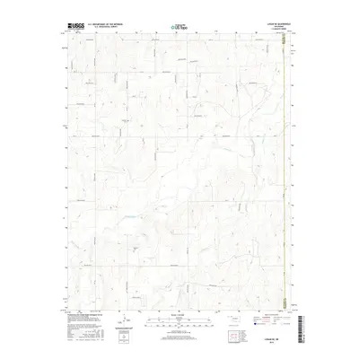
2016 Map of Logan NE
USGS Topo · Published 2016About this map
Kiowa Creek and its southern tributary Camp Cr define the drainage patterns of this corner of Beaver County, where the High Plains transition toward the eastern county line at the Harper County border. The landscape is deeply incised by numerous drainages, including Hollow E0194 and Hollow E0210, which carve out a complex network of ridges and draws. These natural corridors long dictated the placement of early homesteads and transport routes. Evidence of early rural community life is anchored by two established burial grounds: Fairview Cem in the north and Madison Cem to the south. The area is gridded by a systematic network of section roads like NS-163 and Ew-20, which navigate the frequent breaks in the terrain near Kiowa Cr.
Find a feature on this map
41 named features on this map. Tap any name to fly to it.
Don’t see what you’re looking for? This feature index may not catch every label — zoom into the map to look around manually.
Map Details
Editions of this 2016 Logan NE Map
This is the sole edition of this map. No revisions or reprints were ever made.
Other maps of this area

1954 · Perryton
USGS Topo · 1:250,000

1955 · Woodward
USGS Topo · 1:250,000

1958 · Perryton
USGS Topo · 1:250,000

1958 · Woodward
USGS Topo · 1:250,000

1970 · Knowles
USGS Topo · 1:24,000

1970 · Gate
USGS Topo · 1:24,000

1970 · Laverne SW
USGS Topo · 1:24,000

1971 · Logan
USGS Topo · 1:24,000

1971 · Rosston
USGS Topo · 1:24,000

1971 · Logan NW
USGS Topo · 1:24,000