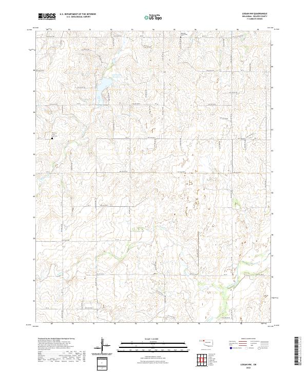
2022 Map of Logan NW
USGS Topo · Published 2022About this map
Lake Evans Chambers and the surrounding high plains of Beaver County define this landscape in the Oklahoma Panhandle. This modern topographical study captures the drainage patterns of the region, where Mexico Creek feeds into the lake from the northwest and Sand Creek meanders toward the southern boundary. The presence of an Oilfield in the northwest corner highlights the ongoing energy production central to the local economy. For those researching family history in this corner of the state, the map identifies two significant burial sites: Highland Chapel Cemetery near the northern border and Fairview Clear Lake Cemetery to the west. These landmarks, along with Kiowa Creek in the southeast, provide essential reference points for a sparsely populated ranching and agricultural territory defined by its section-line roads.
Find a feature on this map
28 named features on this map. Tap any name to fly to it.
Don’t see what you’re looking for? This feature index may not catch every label — zoom into the map to look around manually.
Map Details
Editions of this 2022 Logan NW Map
This is the sole edition of this map. No revisions or reprints were ever made.
Other maps of this area

1954 · Perryton
USGS Topo · 1:250,000

1958 · Perryton
USGS Topo · 1:250,000

1970 · Knowles
USGS Topo · 1:24,000

1970 · Gate
USGS Topo · 1:24,000

1970 · Mocane SE
USGS Topo · 1:24,000

1971 · Clear Lake
USGS Topo · 1:24,000

1971 · Clear Lake SE
USGS Topo · 1:24,000

1971 · Logan
USGS Topo · 1:24,000

1971 · Logan NW
USGS Topo · 1:24,000

1971 · Logan NE
USGS Topo · 1:24,000