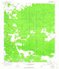
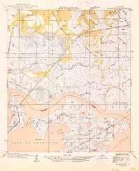
1958 Map of Logtown
USGS Topo · Published 1965About this map
Pearl R and its complex network of waterways define the landscape of south Hancock County in this mid-century survey. The settlement of Logtown stands as a focal point, supported by nearby Logtown Cem and The Point Cem, reflecting the deep-rooted community history of the riverbank. To the south, Pearlington anchors the lower portion of the map, situated among the shifting currents of Whites Bayou and Mulatto Bayou.
Find a feature on this map
19 named features on this map. Tap any name to fly to it.
Don’t see what you’re looking for? This feature index may not catch every label — zoom into the map to look around manually.
Map Details
Editions of this 1958 Logtown Map
4 editions found
Other maps of this area

1893 · Rigolets
USGS Topo · 1:62,500

1893 · Toulme
USGS Topo · 1:62,500

1914 · Nicholson
USGS Topo · 1:62,500

1921 · Nicholson
USGS Topo · 1:62,500

1935 · English Lookout
USGS Topo · 1:31,680

1935 · Grand Island Pass
USGS Topo · 1:31,680

1936 · Rigolets
USGS Topo · 1:62,500

1941 · Honey Island
USGS Topo · 1:31,680
1946 · Rigolets
USGS Topo · 1:31,680

1949 · Grand Island Pass
USGS Topo · 1:31,680