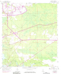
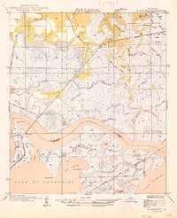
1958 Map of Logtown
USGS Topo · Published 1984About this map
Logtown and Pearlington anchor this coastal Mississippi landscape along the lower Pearl River, a region defined by the vast wetlands of Devils Swamp and Lower Devils Swamp. The map documents a significant era of transition, where traditional riverfront settlements and rural cemeteries like The Point Cem and Logtown Cem exist alongside the sprawling modern footprint of the Mississippi Test Facility (NASA). This massive government installation, served by the Southern railroad, contrasts with the older geography of winding bayous and family-named landmarks like Pate Bayou and Whites Bayou. For genealogists, the inclusion of remote structures such as Mt Zion Ch and Spring Branch Ch provides vital location data for community centers that served this riverine economy before late-century changes.
Find a feature on this map
23 named features on this map. Tap any name to fly to it.
Don’t see what you’re looking for? This feature index may not catch every label — zoom into the map to look around manually.
Map Details
Editions of this 1958 Logtown Map
4 editions found
Other maps of this area

1893 · Rigolets
USGS Topo · 1:62,500

1893 · Toulme
USGS Topo · 1:62,500

1914 · Nicholson
USGS Topo · 1:62,500

1921 · Nicholson
USGS Topo · 1:62,500

1935 · English Lookout
USGS Topo · 1:31,680

1935 · Grand Island Pass
USGS Topo · 1:31,680

1936 · Rigolets
USGS Topo · 1:62,500

1941 · Honey Island
USGS Topo · 1:31,680
1946 · Rigolets
USGS Topo · 1:31,680

1949 · Grand Island Pass
USGS Topo · 1:31,680