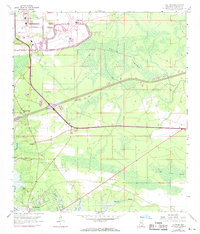
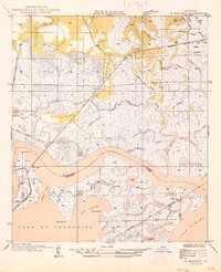
1958 Map of Logtown
USGS Topo · Published 1971About this map
The Mississippi Test Facility (NASA) dominates the northern landscape of this coastal survey, marking the era of space-age expansion in Hancock County. To the south, the settlement pattern transitions from the industrial scale of the facility to established communities like Logtown and Pearlington along the Pearl River. The landscape is defined by the dense wetlands of Devils Swamp and Lower Devils Swamp, which are intersected by numerous waterways including Bogue Homa, Whites Bayou, and Mulatto Bayou. Local history and genealogy interest is concentrated in the riverside settlements, where features such as the Logtown Cem, The Point Cem, and Mt Zion Ch are preserved. The presence of a Microwave Tower, a Lookout Tower, and an Oil Well highlights the region's mid-century infrastructure, while the Southern railroad line provides a critical transportation link across the marshy terrain.
Find a feature on this map
24 named features on this map. Tap any name to fly to it.
Don’t see what you’re looking for? This feature index may not catch every label — zoom into the map to look around manually.
Map Details
Editions of this 1958 Logtown Map
4 editions found
Other maps of this area

1893 · Rigolets
USGS Topo · 1:62,500

1893 · Toulme
USGS Topo · 1:62,500

1914 · Nicholson
USGS Topo · 1:62,500

1921 · Nicholson
USGS Topo · 1:62,500

1935 · English Lookout
USGS Topo · 1:31,680

1935 · Grand Island Pass
USGS Topo · 1:31,680

1936 · Rigolets
USGS Topo · 1:62,500

1941 · Honey Island
USGS Topo · 1:31,680
1946 · Rigolets
USGS Topo · 1:31,680

1949 · Grand Island Pass
USGS Topo · 1:31,680