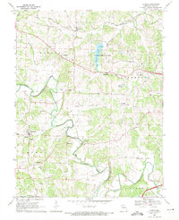
1968 Map of Lohman
USGS Topo · Published 1971About this map
North Moreau Creek meanders through the central hills of Cole County, defining a landscape of small agricultural settlements and rural parish life in the late 1960s. The village of Lohman serves as a local hub, anchored by St Pauls Ch, while nearby Logan and Stringtown mark the path of historical community growth along the winding ridges. To the north, the Pacific Railroad follows the contours near Elston, connecting the region to larger trade networks.
Find a feature on this map
42 named features on this map. Tap any name to fly to it.
Don’t see what you’re looking for? This feature index may not catch every label — zoom into the map to look around manually.
Map Details
Editions of this 1968 Lohman Map
3 editions found
Other maps of this area

1886 · Jefferson City
USGS Topo · 1:125,000

1888 · Tuscumbia
USGS Topo · 1:125,000

1894 · Tuscumbia
USGS Topo · 1:125,000

1894 · Jefferson City
USGS Topo · 1:125,000

1939 · Jefferson City
USGS Topo · 1:24,000

1939 · Jefferson City
USGS Topo · 1:62,500

1942 · Jefferson City
USGS Topo · 1:62,500

1947 · Jefferson City
USGS Topo · 1:250,000

1948 · Centertown
USGS Topo · 1:62,500

1948 · Meta
USGS Topo · 1:62,500