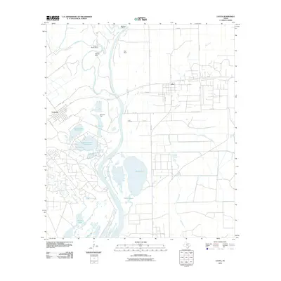
2010 Map of Lolita
USGS Topo · Published 2010About this map
Lolita and Vanderbilt serve as the primary population centers in this Jackson County landscape, situated near the confluence of the Navidad River and the Lavaca River. The terrain is defined by the shifting hydrology of the coastal plain, featuring prominent river loops like Buzzard Roost Bend and Palmetto Bend, alongside broad lowlands such as Menefee Flat. The survey captures the intricate network of local drainage and standing water, from the winding Cox Creek to more substantial bodies like Redfish Lake and the Venado Lakes system.
Find a feature on this map
35 named features on this map. Tap any name to fly to it.
Don’t see what you’re looking for? This feature index may not catch every label — zoom into the map to look around manually.
Map Details
Editions of this 2010 Lolita Map
This is the sole edition of this map. No revisions or reprints were ever made.
Other maps of this area

1952 · Francitas NW
USGS Topo · 1:24,000

1952 · Manson
USGS Topo · 1:24,000

1952 · Point Comfort
USGS Topo · 1:24,000

1952 · Olivia
USGS Topo · 1:24,000

1952 · Edna
USGS Topo · 1:24,000

1952 · Kamey
USGS Topo · 1:24,000

1952 · La Salle
USGS Topo · 1:24,000

1952 · La Ward
USGS Topo · 1:24,000

1952 · Lolita
USGS Topo · 1:24,000

1953 · Beeville
USGS Topo · 1:250,000