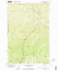
1964 Map of Lolo Hot Springs
USGS Topo · Published 1967About this map
Lolo Hot Springs sits at the northern end of this mid-1960s survey, marking a historic junction of natural waters and mountain transit where Lolo Creek meets the East Fork and West Fork. The landscape is dominated by the high ridgelines and drainages of the Lolo National Forest and Clearwater National Forest, divided by the winding state line between Montana and Idaho.
Find a feature on this map
40 named features on this map. Tap any name to fly to it.
Don’t see what you’re looking for? This feature index may not catch every label — zoom into the map to look around manually.
Map Details
Editions of this 1964 Lolo Hot Springs Map
3 editions found
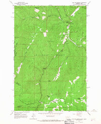
Other maps of this area

1911 · Lolo
USGS Topo · 1:250,000

1912 · Missoula
USGS Topo · 1:125,000

1913 · Lolo
USGS Topo · 1:250,000

1956 · Hamilton
USGS Topo · 1:250,000

1959 · Hamilton
USGS Topo · 1:250,000

1960 · Hamilton
USGS Topo · 1:250,000

1964 · Hamilton
USGS Topo · 1:250,000

1964 · Lolo Hot Springs
USGS Topo · 1:24,000

1964 · Garden Point
USGS Topo · 1:24,000

1964 · West Fork Butte
USGS Topo · 1:24,000