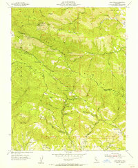
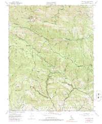
1955 Map of Loma Prieta
USGS Topo · Published 1956About this map
Loma Prieta stands as the dominant peak in this mid-1950s survey of the Santa Cruz Mountains, showing the rugged terrain of the Sierra Azul and the deep canyons that feed the Uvas Reservoir. The map documents a period of technological transition on the summit, featuring a Lookout, Microwave Relay Sta, and Television Relay Sta perched high above the surrounding ridges. To the south and west, the landscape is defined by the Shoquel Augmentation and the drainage systems of Aptos Creek and Corralitos Creek. Local institutions are scattered throughout the hills, including the Future Farmers of America Camp and the recreational settlement at Sveadal. Evidence of past rural life is found at the Eureka Sch (Aband), situated near Eureka Gulch. The complex network of fire roads and trails, such as the Soquel Trail and Highland Way, illustrates the infrastructure required to manage these steep, forested slopes between Santa Clara and Santa Cruz counties.
Find a feature on this map
64 named features on this map. Tap any name to fly to it.
Don’t see what you’re looking for? This feature index may not catch every label — zoom into the map to look around manually.
Map Details
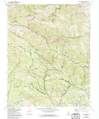
Editions of this 1955 Loma Prieta Map
6 editions found
Other maps of this area

1912 · Capitola
USGS Topo · 1:62,500

1914 · Capitola
USGS Topo · 1:62,500

1915 · San Juan Bautista
USGS Topo · 1:48,000

1916 · New Almaden
USGS Topo · 1:48,000

1917 · Morgan Hill
USGS Topo · 1:62,500

1917 · San Juan Bautista
USGS Topo · 1:62,500

1919 · New Almaden
USGS Topo · 1:62,500

1939 · Morgan Hill
USGS Topo · 1:62,500

1939 · San Juan Bautista
USGS Topo · 1:62,500

1940 · San Juan Bautista
USGS Topo · 1:62,500