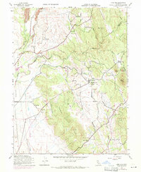
1947 Map of Loma Rica
USGS Topo · Published 1971About this map
Loma Rica and the surrounding foothills of the Sierra Nevada are defined by a complex network of agricultural water systems including Mahle Ditch, Loma Ditch, and the Spring Valley Ditch. This 1947 topographic record, updated with 1969 aerial revisions, reveals the intersection of early mining and established rural education. Resource extraction is evident at the Sweet Vengeance Mine and Smethurst Mine on the southern slopes of Browns Valley Ridge, while local community life is anchored by Fruitland Union Sch and Kings Sch. The landscape is etched with historical settlements like Iowa City and Sunnyside, alongside family-named peaks such as Paynes Peak and Johnson Peak. The map captures the transition from high-elevation drainage toward the lowlands of Jack Slough, preserving the locations of the Honcut Cem and Peoria Cem for genealogical research.
Find a feature on this map
43 named features on this map. Tap any name to fly to it.
Don’t see what you’re looking for? This feature index may not catch every label — zoom into the map to look around manually.
Map Details
Editions of this 1947 Loma Rica Map
3 editions found
Other maps of this area

1888 · Marysville
USGS Topo · 1:125,000

1888 · Smartsville
USGS Topo · 1:125,000

1891 · Marysville
USGS Topo · 1:125,000

1891 · Smartsville
USGS Topo · 1:125,000

1892 · Smartsville
USGS Topo · 1:125,000

1894 · Smartsville
USGS Topo · 1:125,000

1894 · Marysville
USGS Topo · 1:125,000

1895 · Marysville
USGS Topo · 1:125,000

1895 · Smartsville
USGS Topo · 1:125,000

1911 · Browns Valley
USGS Topo · 1:31,680