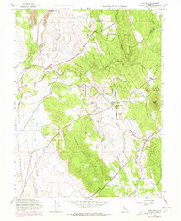
1947 Map of Loma Rica
USGS Topo · Published 1978About this map
The boundary between Butte Co Yuba Co splits this Sierra Nevada foothill landscape, where the agricultural and mining history of Northern California is preserved in detail. Settled around the junction of Loma Rica Road and Fruitland Road, the community of Loma Rica serves as a central hub for the surrounding ranching and orchard lands. The map illustrates a complex water management system vital for the region's survival, including the Browns Valley Ditch, several siphons, and numerous creeks like Honcut Creek and Prairie Creek.
Find a feature on this map
43 named features on this map. Tap any name to fly to it.
Don’t see what you’re looking for? This feature index may not catch every label — zoom into the map to look around manually.
Map Details
Editions of this 1947 Loma Rica Map
3 editions found
Other maps of this area

1888 · Marysville
USGS Topo · 1:125,000

1888 · Smartsville
USGS Topo · 1:125,000

1891 · Marysville
USGS Topo · 1:125,000

1891 · Smartsville
USGS Topo · 1:125,000

1892 · Smartsville
USGS Topo · 1:125,000

1894 · Smartsville
USGS Topo · 1:125,000

1894 · Marysville
USGS Topo · 1:125,000

1895 · Marysville
USGS Topo · 1:125,000

1895 · Smartsville
USGS Topo · 1:125,000

1911 · Browns Valley
USGS Topo · 1:31,680