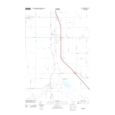
2013 Map of Lomira
USGS Topo · Published 2013About this map
Lomira and Theresa anchor this section of the southeastern Wisconsin landscape, which is defined by a dense network of roads and the headwaters of several notable river systems. The village of Lomira is situated near Crystal Spring and is drained by Lomira Cr, while further south, the E Br Rock River flows through the heart of Theresa. The presence of Theresa Station and the 144 Reservoir suggests a legacy of infrastructure that has shaped the area's growth over decades. To the northwest, Brownsville sits along Kummel Cr, illustrating the typical placement of regional settlements along reliable water sources. This survey captures a highly developed rural-to-suburban landscape, where old established towns are increasingly connected by major arteries like State Road 67 and State Road 28.
Find a feature on this map
66 named features on this map. Tap any name to fly to it.
Don’t see what you’re looking for? This feature index may not catch every label — zoom into the map to look around manually.
Map Details
Editions of this 2013 Lomira Map
This is the sole edition of this map. No revisions or reprints were ever made.
Other maps of this area

1904 · Hartford
USGS Topo · 1:62,500

1955 · Waupun
USGS Topo · 1:62,500

1955 · Campbellsport
USGS Topo · 1:62,500

1955 · Horicon
USGS Topo · 1:62,500

1957 · Madison
USGS Topo · 1:250,000

1959 · Hartford
USGS Topo · 1:62,500

1959 · Nenno
USGS Topo · 1:24,000

1959 · Allenton
USGS Topo · 1:24,000

1960 · Madison
USGS Topo · 1:250,000
1974 · Campbellsport
USGS Topo · 1:24,000