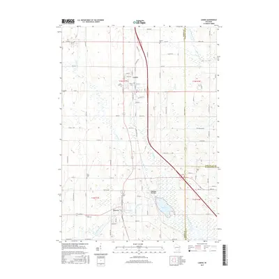
2015 Map of Lomira
USGS Topo · Published 2015About this map
The East Branch Rock River and its impounded Theresa Millpond anchor the southern portion of this landscape, reflecting the long-standing water-powered industrial roots of the village of Theresa. This modern 2015 survey reveals the established grid of Lomira to the north, which sits at a critical junction near Crystal Spring. The map is particularly valuable for genealogists, as it meticulously identifies numerous local burial grounds including Saint Marys Cem, Emanuel Cem, and Wayne Cem scattered across the township lines. The terrain is defined by the underlying glacial history, evident in the drainage patterns of Lomira Cr and Kimmel Cr. The infrastructure of Theresa Station and the various county roads illustrate the continued importance of this corridor for movement between the major regional population centers.
Find a feature on this map
68 named features on this map. Tap any name to fly to it.
Don’t see what you’re looking for? This feature index may not catch every label — zoom into the map to look around manually.
Map Details
Editions of this 2015 Lomira Map
This is the sole edition of this map. No revisions or reprints were ever made.
Other maps of this area

1904 · Hartford
USGS Topo · 1:62,500

1955 · Waupun
USGS Topo · 1:62,500

1955 · Campbellsport
USGS Topo · 1:62,500

1955 · Horicon
USGS Topo · 1:62,500

1957 · Madison
USGS Topo · 1:250,000

1959 · Hartford
USGS Topo · 1:62,500

1959 · Nenno
USGS Topo · 1:24,000

1959 · Allenton
USGS Topo · 1:24,000

1960 · Madison
USGS Topo · 1:250,000
1974 · Campbellsport
USGS Topo · 1:24,000