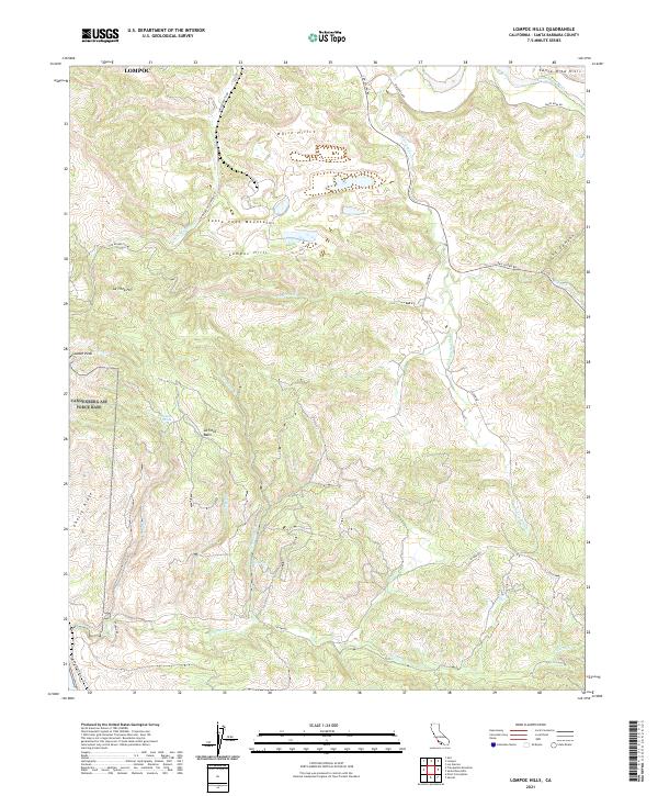
2021 Map of Lompoc Hills
USGS Topo · Published 2021About this map
The Santa Ynez Mountains and the lower Lompoc Hills define this coastal California landscape, where the Santa Ynez River flows toward the sea. The terrain is marked by deep drainage basins and ridges, including the La Tinta Basin and Cherry Ridge. Long-established ranch and access roads such as San Miguelito Rd and Jalama Rd wind through the canyons, connecting the interior heights with the Santa Barbara coast. This modern survey shows the complex network of watercourses that have shaped the region's geography, from Salsipuedes Cr to the smaller Escondido Cr. Notable geological and hydrological features like Sulphur Spring and Big Spring provide insight into the natural water sources critical to this Mediterranean climate. The map also delineates the Santa Rita Hills and White Hills, areas characterized by distinct elevations and seasonal stream activity.
Find a feature on this map
46 named features on this map. Tap any name to fly to it.
Don’t see what you’re looking for? This feature index may not catch every label — zoom into the map to look around manually.
Map Details
Editions of this 2021 Lompoc Hills Map
This is the sole edition of this map. No revisions or reprints were ever made.
Other maps of this area

1905 · Guadalupe
USGS Topo · 1:125,000

1905 · Lompoc
USGS Topo · 1:125,000

1942 · Point Arguello
USGS Topo · 1:62,500

1942 · Guadalupe
USGS Topo · 1:125,000

1942 · Lompoc
USGS Topo · 1:125,000

1942 · Lompoc
USGS Topo · 1:62,500

1942 · Pt. Conception
USGS Topo · 1:62,500

1943 · Lompoc
USGS Topo · 1:125,000

1947 · Lompoc
USGS Topo · 1:24,000
1947 · Santa Rosa Hills
USGS Topo · 1:24,000