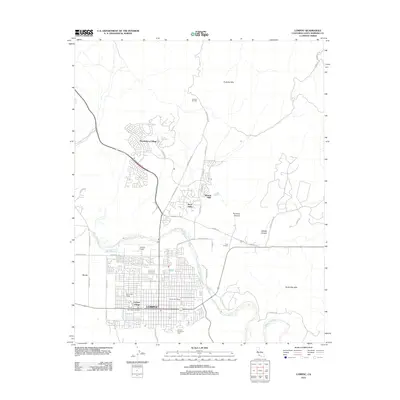
2012 Map of Lompoc
USGS Topo · Published 2012About this map
Lompoc and its surrounding coastal valley are defined by a mix of agricultural heritage, oil production, and the expanding residential footprints of Vandenberg Village and Mission Hills. The Santa Ynez River snakes across the center of the sheet, dividing the urban grid from the northern foothills of the Purisima Hills. Industrial and logistics footprints are prominent, from the Lompoc Oil Field in the north to the Lompoc Airport and the rail-linked sidings that supported local industry. Genealogists and local historians can trace the town's development through the street-level detail of Lompoc Village, the location of the Post Office, and the site of Lompoc Evergreen Cem on the southern edge of town. To the east, the landscape transitions into the specialized geography of Cebada Canyon and the Santa Rita Hills, while legacy rail infrastructure like Parks-Lead Siding and White Hills Siding points to the area's commercial past.
Find a feature on this map
41 named features on this map. Tap any name to fly to it.
Don’t see what you’re looking for? This feature index may not catch every label — zoom into the map to look around manually.
Map Details
Editions of this 2012 Lompoc Map
This is the sole edition of this map. No revisions or reprints were ever made.
Other maps of this area

1905 · Guadalupe
USGS Topo · 1:125,000

1905 · Lompoc
USGS Topo · 1:125,000

1942 · Point Arguello
USGS Topo · 1:62,500

1942 · Guadalupe
USGS Topo · 1:125,000

1942 · Lompoc
USGS Topo · 1:125,000

1942 · Lompoc
USGS Topo · 1:62,500

1942 · Santa Maria
USGS Topo · 1:62,500

1942 · Point Sal
USGS Topo · 1:62,500

1943 · Lompoc
USGS Topo · 1:125,000

1947 · Lompoc
USGS Topo · 1:24,000