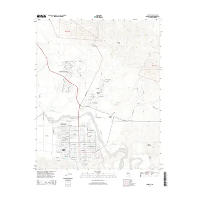
2015 Map of Lompoc
USGS Topo · Published 2015About this map
Lompoc anchors this 2015 survey, situated within the fertile Lompoc Valley where the Santa Ynez River flows toward the coast. The grid of the city is clearly defined, reaching from the Lompoc Airport in the north to Lompoc Evergreen Cem in the south. Residential developments like Vandenberg Village, Mission Hills, and Mesa Oaks show the northward expansion of the community into the foothills.
Find a feature on this map
122 named features on this map. Tap any name to fly to it.
Don’t see what you’re looking for? This feature index may not catch every label — zoom into the map to look around manually.
Map Details
Editions of this 2015 Lompoc Map
This is the sole edition of this map. No revisions or reprints were ever made.
Other maps of this area

1905 · Guadalupe
USGS Topo · 1:125,000

1905 · Lompoc
USGS Topo · 1:125,000

1942 · Point Arguello
USGS Topo · 1:62,500

1942 · Guadalupe
USGS Topo · 1:125,000

1942 · Lompoc
USGS Topo · 1:125,000

1942 · Lompoc
USGS Topo · 1:62,500

1942 · Santa Maria
USGS Topo · 1:62,500

1942 · Point Sal
USGS Topo · 1:62,500

1943 · Lompoc
USGS Topo · 1:125,000

1947 · Lompoc
USGS Topo · 1:24,000