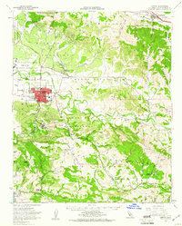
1959 Map of Lompoc
USGS Topo · Published 1961About this map
The coastal plains and canyons of Santa Barbara County are captured here during a period of significant military and industrial growth. Vandenberg Air Force Base occupies the northwestern corner, signaling the region's mid-century transition toward aerospace operations. The city of Lompoc sits centrally at the junction of the Santa Ynez River and Miguelito Creek, with its street grid anchored by Ryon Mem Park and the Lompoc Municipal Airport.
Find a feature on this map
71 named features on this map. Tap any name to fly to it.
Don’t see what you’re looking for? This feature index may not catch every label — zoom into the map to look around manually.
Map Details
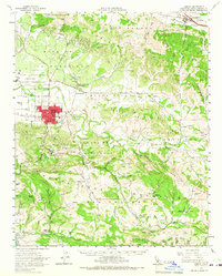
Editions of this 1959 Lompoc Map
2 editions found
Other maps of this area

1905 · Guadalupe
USGS Topo · 1:125,000

1905 · Lompoc
USGS Topo · 1:125,000

1942 · Point Arguello
USGS Topo · 1:62,500

1942 · Guadalupe
USGS Topo · 1:125,000

1942 · Lompoc
USGS Topo · 1:125,000

1942 · Lompoc
USGS Topo · 1:62,500

1942 · Pt. Conception
USGS Topo · 1:62,500

1942 · Santa Maria
USGS Topo · 1:62,500

1942 · Gaviota
USGS Topo · 1:62,500

1942 · Point Sal
USGS Topo · 1:62,500