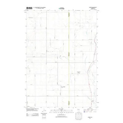
2013 Map of London
USGS Topo · Published 2013About this map
London sits at the heart of this rural southern Minnesota landscape, where the agricultural grid of Freeborn and Mower counties meets. The settlement is anchored by a Po (Post Office) and serves as a focal point for a surrounding community defined by multi-generational family landmarks. The area's history is preserved in several small burial grounds scattered across the townships, including the Kennevan Family Cem, London Cem, and Deer Creek Cem.
Find a feature on this map
40 named features on this map. Tap any name to fly to it.
Don’t see what you’re looking for? This feature index may not catch every label — zoom into the map to look around manually.
Map Details
Editions of this 2013 London Map
This is the sole edition of this map. No revisions or reprints were ever made.
Other maps of this area

1954 · Hayward
USGS Topo · 1:62,500

1954 · Austin
USGS Topo · 1:62,500

1954 · Mason City
USGS Topo · 1:250,000

1957 · Mason City
USGS Topo · 1:250,000

1958 · Mason City
USGS Topo · 1:250,000

1972 · St. Ansgar
USGS Topo · 1:24,000

1972 · Northwood
USGS Topo · 1:24,000
1972 · Carpenter
USGS Topo · 1:24,000
1982 · Austin East
USGS Topo · 1:24,000

1982 · Hayward
USGS Topo · 1:24,000